-
[B][COLOR="#0000CD"]Our club was born in blood and boots, not in AFL focus groups.[/COLOR][/B] -
Re: Everybody's thinking about the rain
‘Unprecedented’: At lease three state’s drenched as storms continue
TOWNS could be evacuated as the big wet continues. Victoria, NSW and the ACT are on alert as the rain continues to pour down.
Benedict Brook
FORECASTERS were worried 200mm of rain could fall in just a few days over parts of Victoria, overnight almost 200mm fell in just a few hours.
Parts of Victoria have seen their heaviest rainfall ever with several hundred millimetres falling on Strathbogie and 170mm at Euroa in the state’s north. Strathbogie has seen 165mm just since 9am on Saturday.
All eyes are on north east Victoria, southern NSW and Canberra where it could bucket it down. While Melbourne is getting a respite from the rain, it could return this evening with 30-40mm falling.
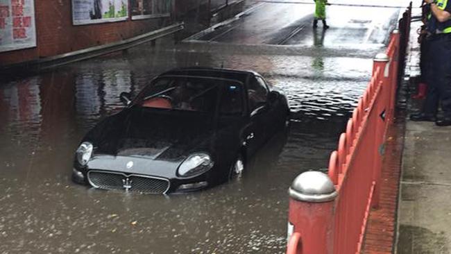
The SES has received more than 1300 calls for help so far, roughly half of them in the Melbourne area.
On Saturday, the Bureau of Meteorology (BoM) defended its dire warnings after eyebrows were raised following far lighter downpours in Melbourne than were expected. “The way that it’s panned out has been similar to what we were predicting,” said the Bureau’s Dr Andrew Tupper.
The emergency services are particularly concerned about conditions in Euroa and Myrtleford and may order the towns to be evacuated. Several sections of the M31 Hume Freeway near Seymour have been closed due to flooding.
Other states have also been hit. Canberra saw 35mm of rain and Wagga Wagga 43mm. Rain is continuing today with heavy downpours in Sydney predicted for Saturday afternoon.
Victorians have been warned to expect an “unprecedented” deluge today with severe thunderstorm and flood warnings across the region. A severe weather warning remains in place for heavy rainfall, thunderstorms and flash flooding in much of the state including Melbourne.
Up to 120mm could fall in the border town of Albury-Wodonga. There is a flood warning for Melbourne’s Yarra River with fears it could burst its banks.
Melbourne was spared the worst of the rain with around 20mm falling overnight in the CBD. But but you didn't have to travel far for the downpours to get much worse. Bundoora, in the northern suburbs, saw almost 40mm of rain. Coldstream, in the Yarra Valley, got past 50mm of rain. And the rain just got heavier outside the city.
On Saturday, Victorian Premier Daniel Andrews said the worst was over for Melbourne but it was a different story in the rest of the state.
“Some of these rainfall totals we’ve seen (are) well and truly the entire summer’s rain almost in just a 24-hour period,” he said.
“That is unprecedented and has put a significant strain on many different communities and some communities are certainly not out of danger or this event will continue to unfold in a number of communities, particularly in the northeast of the state.”
The BoM’s Dr Tupper said Melbourne was lucky to escape the worst of the rain which skirted the city’s northern outskirts.
“Although Melbourne has thankfully been on the fringe of the affected area, there is the potential for enough rainfall for flash flooding.
“There may be totals of 40mm tonight (but) probably not too much in the day today.
“But tonight in technical terms we’re expecting some convergence between two streams of wind to form a line somewhere over
Melbourne, possibly the western parts of Melbourne, possibly with falls of 20-40mm.”
He defended the BoM’s warnings including that the rain could cause a “threat to life”. At one point on metrologist compared the rain to the Titanic sinking saying, “They didn’t think the Titanic would sink, but it did two hours later.”
“You judge the severity of the event, before you know exactly where that event is going to hit,” said Dr Tupper.
“That’s why we went out very hard because we could see it was certainly going to be a large and impacting weather event,” he said.
’We’re getting much better at forecasting it but we know we won’t always get it with precision three or four days before the event. The way that it’s panned out has been similar to what we were predicting.”
An elderly couple became trapped in their car in floodwaters near Seymour on Friday night, rescued by a farmer in a tractor who plucked them to safety.
Late on Friday, Victoria’s Emergency Services Commissioner Craig Lapsley warned, “We’re not out of it. It hasn’t necessarily been across the state yet but it’s coming and the Bureau has been very clear in their forecast. The forecasted rain for Saturday is in the hundreds of millimetres. It could go as far as 250mm in the northeast.”
“Saturday is the day and the Bureau is very clear (there will be) hundreds of millimetres of rain.”
He said the north east Victoria region, including Wangaratta, was the area of the biggest concern with “hundreds of millimetres” of rainfall forecast.
“It could go as far as 250mm in the north east,” he said.
“However, it’s widespread rain so don’t underestimate what it means.”
The real fear is sudden and intense deluges associated with thunderstorms which could give a downpour destructive force.
Mr Lapsley said the Elwood canal, south east of Melbourne, was breaching and “will impact on properties”.
“We’ll have the normal December rainfall in two days. It’s coming.”
Several major events in Melbourne have been cancelled including Taste of Melbourne, Polo in the City, Opera in the Bowl, Arts Centre Melbourne’s outdoor Christmas market, Tennis Victoria Premier League, and all grades of Victorian Premier Cricket.
Five hundred State Emergency Services (SES) staff are on standby in Victoria. The number one piece of advice: do not drive through flood waters.
Research released on Friday from NRMA Insurance showed a third of drivers weren’t confident of their skills in heavy rain.
“The reality is, it only takes a small amount of floodwater to make even a large vehicle unstable and potentially float away,” spokesman Ramana James said.
Sky News Weather’s Mr Saunders told news.com.au a complex low pressure system is behind the weather event.
“A very warm and humid northerly airstream has drifted over southeast Australia and will clash with cold air moving north from the Southern Ocean,” he said.
“Warm air colliding with cold air is a volatile mix and led to the formation of a deep and complex low pressure system over southeast Australia.”
Mr Saunders said weather patterns across Australia took a dramatic swing this spring over Australia following the driest September on record for parts of eastern Australia.
He said “rain arrived with a deluge” in October and continued through November, which boosted the seasonal figures to near or even above average for many regions.
“Brisbane has totalled over 250mm by the end of November, the city’s wettest spring in seven years,” he said.
WEEKEND FORECAST
ADELAIDE
Most of the rain has passed for South Australia. 20-22C for the next few days and possible showers.
MELBOURNE
Up to 40mm could fall on Saturday and a further 10mm on Sunday. Cloudy with possible sunny breaks when the clouds pass. Highs of 19C. A severe weather warning is in place though for heavy rain at times, thunderstorms and flash flooding so stay alert.
REGIONAL VICTORIA
The further north and east you go the wetter it gets with heavy and persistent rain for areas like Shepparton, Wangaratta and Bairnsdale. Wodonga could see between 40-120mm of rain. A severe weather warning is in place though for heavy rain at times, thunderstorms and flash flooding so stay alert.
HOBART
A 100 per cent chance of rain on Saturday but the gauge shouldn’t get to more than 8mm with some showers on Sunday. Highs of around 14-15C.
CANBERRA AND SOUTHERN NSW
Heavy rain across the weekend broken by some dry spells. Expect 10-15mm of rain for the next few days and high of around 18-20C. Wagga Wagga and Albury could see heavier downpours. A severe weather warning for heavy rain and damaging winds in higher areas is in place for much of southern and inland NSW.
SYDNEY
Rain increasing on Saturday and then easing on Sunday with highs of 28C. Heavy downpours are forecast for early next week of up to 20mm for Monday and Tuesday so keep a brolley handy.
BRISBANE
A relatively dry Saturday but then a stormy Sunday and start to the week. 30mm could fall on Sunday and then a soggy 40mm on Monday with the possibility of thunderstorms.
DARWIN
32-34C across the Top End with sunshine and storms with Monday the wettest with up to 30mm of rain.
PERTH — less than 5mm
Never one to play the east coast’s game, Perth is a model of summertime weather this weekend. Clear skies every day, temperatures will reach 35C on Saturday and 37C on Sunday before dropping to 27C on Monday with the chance of a shower.Last edited by Eastdog; 02-12-2017, 01:22 PM."Footscray people are incredible people; so humble. I'm just so happy - ecstatic"Comment
-
Re: Everybody's thinking about the rain
They weather forecasters have been all talk but it's all been a bit of a fizzer so far.They say Burt Lancaster has one, but I don't believe them.Comment
-
Re: Everybody's thinking about the rain
There has been rainfall a lot more severe in the past to what we are experiencing now."Footscray people are incredible people; so humble. I'm just so happy - ecstatic"Comment
-
Re: Everybody's thinking about the rain
I work in the CBD in an office and first time in 15 years that I have worked for them, we were sent home early because of the predicted rain. We left at 4pm as the anticipated deluge was supposed to be huge between 5 & 6pm.
They also postponed our Company Christmas Party - after talks with the Venue, HR, Police & the Weather bureau.[B][FONT="Book Antiqua"][COLOR="DarkOrchid"][I]I bleed Red,White & Blue[/I][/COLOR] [/FONT][/B]Comment
-
Re: Everybody's thinking about the rain
Wough. Here it comes...They say Burt Lancaster has one, but I don't believe them.Comment
-
Last edited by Bornadog; 02-12-2017, 06:10 PM.FFC: Established 1883
Premierships: AFL 1954, 2016 VFA - 1898,99,1900, 1908, 1913, 1919-20, 1923-24, VFL: 2014, 2016 . Champions of Victoria 1924. AFLW - 2018.Comment
 Tweet
Tweet

Comment